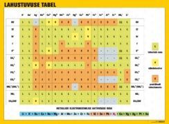
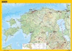
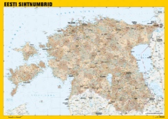
Description
The table map shows the administrative division of Estonia on one side and the general, physical map of Estonia on another side.
Laminated on both sides.
Dimensions 42 x 30 cm (approx. A3)
The dimensions of the card may vary few centimeters (cm) depending on the layout. The pictures are illustrative.