Geospatial Solutions
Map Applications
Map applications are applications designed for use on desktop computers, mobile devices, or web browsers, where the user’s primary interaction takes place on a map. These applications can be interactive, dynamic, and/or static. In the case of static map applications, a fixed map image is presented, with the primary role of the application being data retrieval and map display. Static map applications can be transformed into dynamic ones, for instance, through animation, making data visualization more appealing.
Interactive map applications provide users with the opportunity to perform various actions on the map, such as observing information layers, searching for locations, calculating routes, and more.
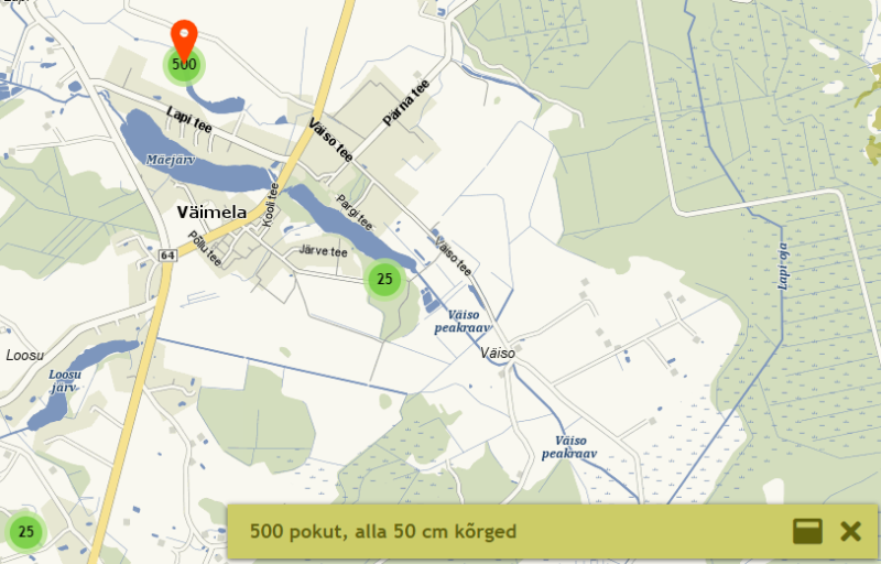
Map applications can be entirely standalone or integrated as part of a larger information system. For example, in a real estate portal, they can be used to display properties and nearby points of interest on the map. Map applications can be used for visualizing statistical data, searching for and displaying locations, route planning, displaying and processing spatial data, in games, and more.
In the realm of map applications, Regio has the capability to offer solutions in the increasingly utilized field of geolocation marketing. Geolocation marketing assesses objectively location-specific factors that impact the success of stores, sales territories, target audiences, retail chains, and distribution networks, offering companies the opportunity to analyze new avenues for securing a competitive market position.
Map applications can be built upon raster or vector maps. In the case of raster maps, the base is a raster image in .jpg or .png format, pre-rendered by a map server and displayed as such in the application. For vector maps, the application retrieves vector data from the map server, and the map image is drawn directly within the application. Thanks to this, vector maps allow for map rotation and tilting, dynamic map styling based on top information layers (location map vs navigation map), and even day and night modes (dark vs light-themed map).
Reference

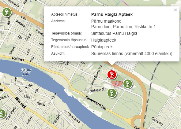
“The map application originally developed for the pharmacy reform is visually catching, informative and user-friendly. The cooperation with Regio has been very positive and all the works has been completed on time. Regio has been always ready to provide updates on time and is ready to work around the clock when the application requires changes.
Marju Sammul, Statistics Bureau of the State Agency of Medicines