Geospatial Solutions
Major GIS Projects
- GIS project for digitalization of base layers of visual operation and aerodrome charts for Deutsche Flugsicherung GmbH.
- Pre-processing of geodata for fiberoptic planning in Germany, designed by Estonian Fiber OÜ.
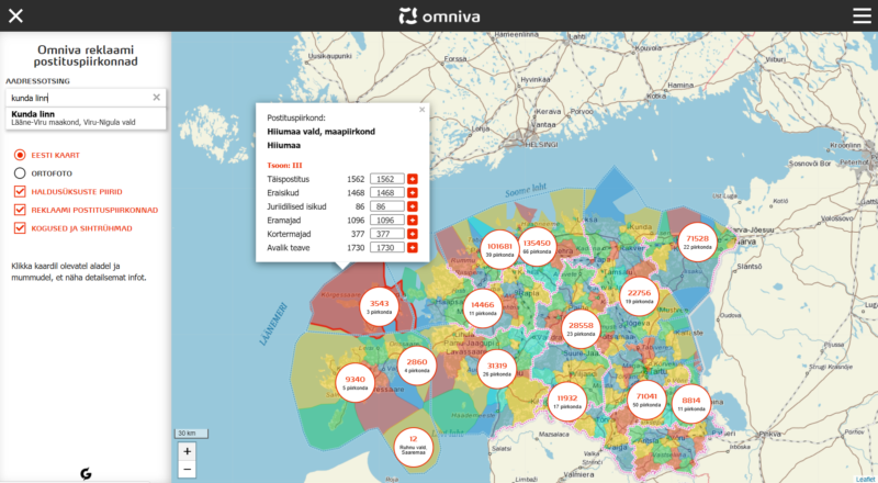
- Development of map application for Estonian Postal Service (Omniva).

- Development of map application for Estonian State Agency of Medicines.
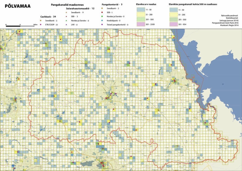
- Production of infographic maps for analysing banking channels and population density for the National Bank of Estonia.
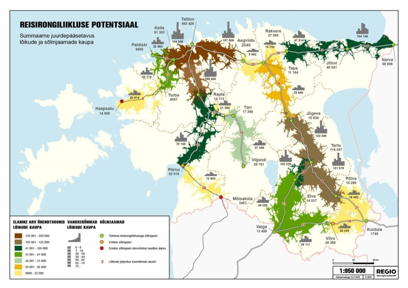
- Creation of thematic and infographic maps projecting rail passenger flows and train users’ behavior for the Ministry of Finance.
- Creation of a dataset for Tartu City Government, modelling transportation networks for vehicles and pedestrians.
- Creation and updates of road navigation layers and points of interest for the Information Technology and Development Centre of the Ministry of the Interior.
- Creation of airport obstacle database for Tallinn Airport.
- Development of a mobile app “Regio Eesti Teed” (Estonian road network).
- Performance of numerous tasks to create different data layers and develop QGIS software tools according to customers’ specifications.
- Spatial data capturing according to the Multinational Geospatial Co-production Program (MGCP) specification.
- Arrangment of Viimsi municipality’s road database and data tables.
- Identification of geological survey areas and creating the spatial database for the Estonian Geological Survey.
- Development of a map application for the University of Tartu providing a visual overview of Covid-19 related wastewater measurement.
- Production of thematic maps for Garmin GPS devices for the Estonian electricity transmission operator (Elering).
- GIS project for collecting and processing Latvian and Lithuanian spatial data according to the requirements of multiple customers.
- Generalising and processing Estonian topographic data for the Estonian Land Board for the production of the Estonian Base map.
- Digitalisation of spatial data for the Estonian Defense Forces.