Routing – the Invisible Guide That Saves Time and Money
Automatic Translation by ChatGPT
Modern life moves fast. Deliveries must arrive on time, customers expect precision, and every extra minute means additional cost. The saying “time is money” has never been more true. One of the most effective ways to save both is intelligent routing — calculating optimal routes based on accurate spatial data.
Routing with the Regio API
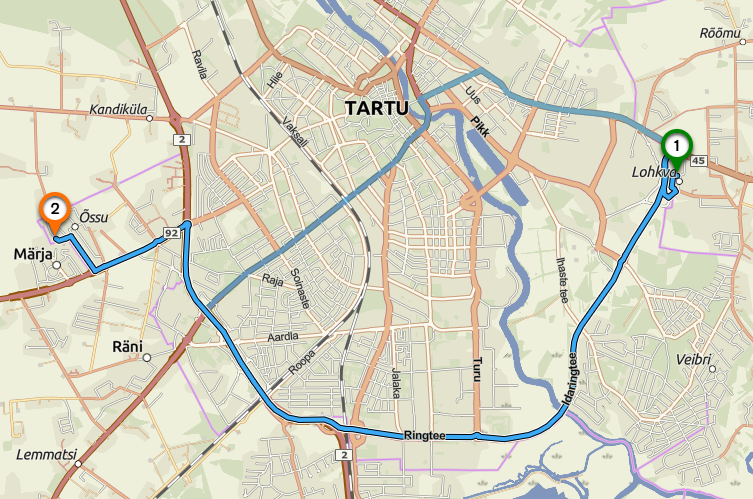
At its core, routing means calculating a route from point A to point B. In practice, however, it is far more than drawing a line on a map. Reliable navigation depends on high-quality geospatial data layered on top of GPS positioning.
The Regio API is built on continuously updated, highly detailed base data, including:
- Road network geometry
Our datasets include precise representation of road hierarchies, connectivity, and network topology. - Traffic directions and access restrictions
Equally important are one-way streets, restricted zones, bus lanes, and vehicle access rules. - Speed data and travel conditions
Official speed limits combined with real-world travel speeds influenced by congestion, time of day, and weather are essential for accurate travel time estimation and fastest-route calculation. - Turn restrictions and intersection logic
Permitted and prohibited turns, roundabout behavior, and grade-separated junctions are all modeled explicitly. - Vehicle-specific routing rules
Different vehicle classes follow different regulations and access constraints.
Accurate routing is therefore not a single calculation, but a dynamic decision process based on precise road geometry, validated traffic rules, and current travel conditions. This ensures reliable and realistic route results.
Fastest route vs. shortest route
A common assumption is that the shortest route is always the best option. In reality, shortest and fastest routing represent two fundamentally different optimization strategies — both fully supported by the Regio routing engine.
The shortest route is optimized purely for distance, which can direct traffic through narrow residential areas and gravel roads, frequently increasing overall travel time.
The fastest route prioritizes travel speed, road class, and traffic flow, guiding vehicles along corridors that enable smooth movement and avoid bottlenecks.
The Regio API allows users to select the optimization strategy that best fits their operational goals — minimizing distance or minimizing time.
Same origin and destination — different optimal routes
Imagine a scenario where a passenger car and a heavy timber truck start from the same location and travel to the same destination. Should they use the same route? Most likely not.
Different vehicles and modes of travel require different roads. This is where the Regio API comes into play, allowing users to select routing profiles tailored to specific use cases:
- Passenger car – a profile that prioritizes paved roads and smooth, standard driving maneuvers.
- Heavy truck – a profile that accounts for weight and size restrictions and avoids road segments unsuitable for large vehicles.
- Pedestrian – a profile that utilizes sidewalks, footpaths, and non-motorized routes.
- Emergency vehicle – a specialized profile designed for urgent situations, enabling the fastest possible response while allowing exceptions to certain standard traffic restrictions.
How accurate routing saves time and money
Precise routing delivers direct and quantifiable benefits.
- Reduced fuel consumption through optimized travel paths.
- Improved delivery reliability via accurate travel time prediction
- Lower vehicle wear and maintenance costs by avoiding unsuitable road segments
Conclusion
Each route is a sequence of spatial decisions — which roads to use, which to avoid, and how long the journey will take. When those decisions are driven by accurate, up-to-date geospatial data, transportation becomes efficient and predictable. When they are not, delays and inefficiencies are inevitable.
Regio provides routing solutions built on trusted local datasets, supporting smarter mobility and logistics decisions across the Baltic region.
For accurate and flexible geospatial data solutions, contact maps@regio.ee
 Alisa Lillemets
