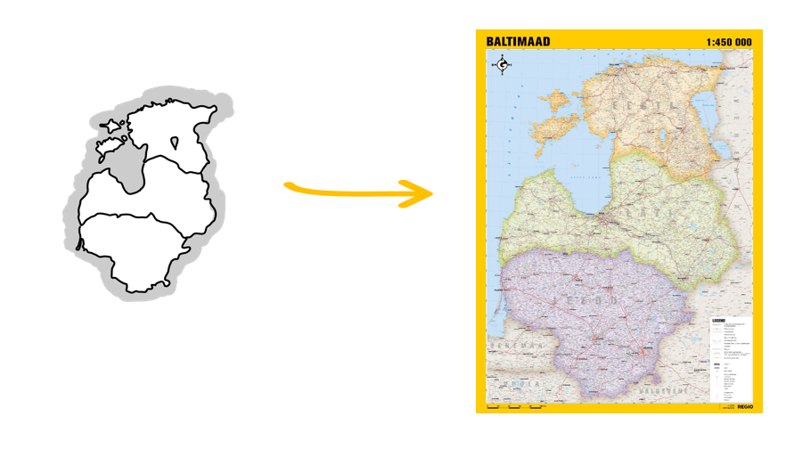
From Purekkari to Druskininkai and Beyond: Challenges in Creating and Managing a Dynamic International Spatial Database
Automatic Translation by ChatGPT
Õie Nikkel, Regio spatial data engineer
One of Regio’s core activities is the continuous maintenance of a spatial database covering the Baltic states.
Accurate and up-to-date data ensure that our clients’ map applications provide reliable information throughout the entire Baltic region. Correct address and navigation data help users find their destinations more easily and allow our clients to offer better services. Whether it’s addresses, road networks, building footprints, or points and areas of interest (POI and AOI), our data help businesses and individuals navigate space and make precise decisions.
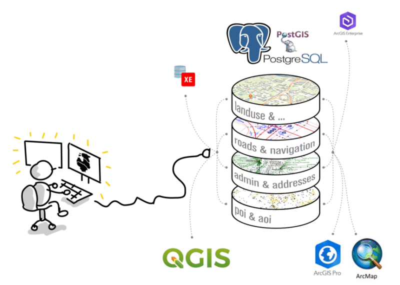
In 2024, we carried out a significant technological upgrade by migrating our database from Oracle to the PostgreSQL database management system. Combined with QGIS software, this change has given us greater capacity to process and manage data more efficiently.
Managing a dynamic and international spatial database presents its own set of challenges, which we will explain in more detail below.
Local Expertise in All Three Baltic Countries
Our daily work involves maintaining data from three countries with a unified structure and level of accuracy. This means our clients don’t need to worry about merging different systems or data formats—we take care of that work for them.
We use numerous data sources to ensure our database stays current and constantly adapt to advances in technology. This allows us to meet our clients’ expectations and deliver the most up-to-date and precise spatial data available.
Managing a unified database across three countries requires extensive expertise and a high level of precision. Our team is well-versed in the specific characteristics of all three Baltic states, from linguistic nuances to differences in traffic regulations. Latvian and Lithuanian are no longer intimidating when specific terms like įkrovimo stotelė (charging station), šķērslīnija (cross street), apylinkių seniūnija (suburban district), or pilsētiņa (small town) are clearly understood in both form and meaning.
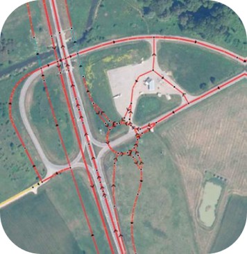
We have thoroughly studied and reviewed the traffic laws of each country and invested countless hours and days into refining navigation data for both major and minor traffic junctions. As a result, our database includes highly accurate data: number of lanes, permitted speeds and speed limits, street names, road numbers, turn restrictions, signpost information, and various traffic limitations based on vehicle type, weight, height, or width. Thanks to this level of detail, we are able to offer data that supports precise and reliable navigation.
Continuous Data Updating
Adding new data to a database once or compiling a data layer from various sources may seem straightforward—but the real challenge lies in continuously and consistently keeping the data up to date.
To update our database, we use two main strategies:
- Full replacement, where the entire dataset is replaced each time with a newer version.
- Change detection, where we monitor source data for updates and insert only the changes.
At first glance, full replacement may appear easier and faster, but it requires that the database structure remain consistent across all three countries. However, the source data from each country varies, and their tabular data and geometry rules often don’t align with our internal standards. Therefore, data always needs to be cleaned and harmonized before integration.
Change detection and processing involves comparing datasets from different points in time—say, monthly or biannually. We identify the changes and insert them into our database while preserving table relationships and previously made corrections.
This is how we regularly update addresses, points of interest (POIs), buildings, roads, and administrative boundaries—ensuring the accuracy and consistency of the spatial database.
Data Entry and Automation
Data updates and entry are performed either manually or automatically.
With manual updates, a geoinformatics specialist makes the necessary changes using QGIS software, relying on custom-built plugins tailored to our database structure and rules. While this approach is time-consuming, it gives the geoinformatician full control and a precise overview of both the data and their own actions.
Automatic updates are handled through PostgreSQL database procedures, which accelerate data processing and streamline the overall workflow. However, implementing automation requires thorough development work and comes with certain risks — such as inconsistencies in table structures or ID fields in the original data sources, or even the possibility that the data becomes unavailable altogether.
Automation pays off when dealing with frequently updated data from reliable sources, such as points of interest (POIs) or addresses.
What’s Next?
The challenges of managing a dynamic and international database and producing high-quality data remain largely the same as the database expands to cover additional countries. We have built a universal system that allows us to easily incorporate new countries’ data while using the same proven cleaning and management processes already in place.
When it comes to spatial data geometry types, the automatic correction of points and polygons is relatively simple and can be handled with standard GIS tools. However, automating the updating and correction of line features—such as roads and borders—is much more complex. Our goal is to develop an efficient system for managing these line geometries accurately and automatically as well.
Additionally, certain categories of spatial data, like navigation data, are becoming increasingly time-sensitive. The integration of real-time data is becoming more and more critical in this area. This is one of the key fields where we see great future potential and an opportunity to further enhance our solutions.

