From Detailed Spatial Databases to Wall Maps – ArcGIS at Regio
Merle Annov, Co-SEO and Head of Cartography at Regio, gave a presentation at the 2025 ESRI Days in Tallinn, which is available here (in Estonian): https://www.youtube.com/watch?v=weAqddTyI3A&t=8s
How Regio came to use ESRI software and what challenges map-making involves are summarized in the following blog post.
Regio’s Early Years – From Paper Maps to Digital
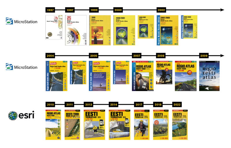
The first Regio map was published in 1989, and the early years were marked by intense, hand-drawn work on various tourism and thematic maps. The lack of accurate maps during the Soviet era had created such high demand that cartographers often sacrificed sleep to keep up. Soon computers entered the picture, and from the mid-1990s onward, it felt like we had stepped onto a technological highway – the production process had to be repeatedly adapted to new software and solutions.
Digital Milestones
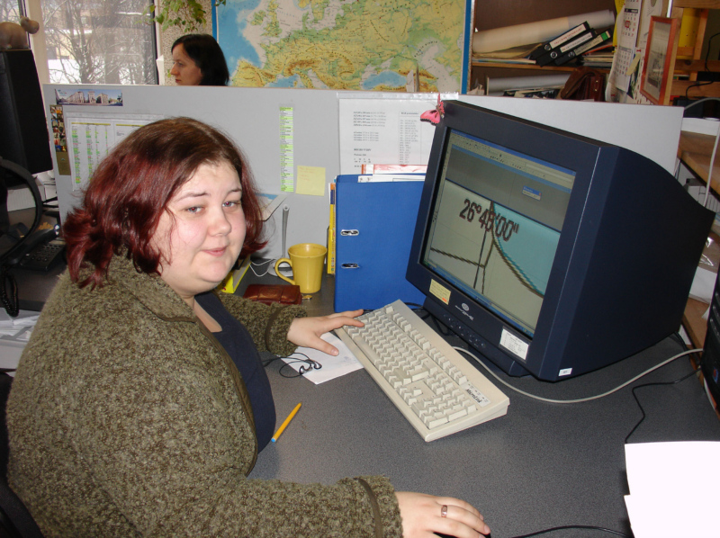
Regio was the first mapping company in the Baltic region to make its cartographic production process fully digital in 1994. We began working with MicroStation and MapInfo for spatial data, and also used CorelDRAW for map design.
In 1997, we made the next big leap – spatial data became database-backed, and we created the first road map that allowed route calculation on a computer. For its time, this was a revolutionary solution. In cooperation with IBS, the first public internet server was launched, and in 2001, as a logical next step, we began offering online map services – before Google Maps or Estonia’s Land Board X-GIS.
At the end of the 1990s and into the early 2000s, progress accelerated in even bigger steps. The development of a Baltic road navigation database gained momentum, and our spatial database became increasingly detailed. The demands on the software we used grew as well. Times had changed – spatial data was becoming the priority, with maps playing a supporting role.
From CAD to GIS – 19 Years of ArcGIS at Regio
We first encountered ESRI software through two major projects: creating a reality and presentation model for the Tallinn City Government in 2007, and publishing sheets of Estonia’s basic map for the Estonian Land Board (now the Estonian Land and Spatial Development Board) in 2009.
Around this time, we also began transitioning our production process from MicroStation to ESRI. The first Regio Estonian Road Atlas created using ESRI software was published in 2010, and the first atlas made entirely with ESRI software was the 2012 Baltic Road Atlas. The transition was not easy – turning a big “ship” always takes time, especially when work cannot stop in the meantime. Today, we are once again in the midst of change: moving from ArcInfo to ArcGIS Pro. Each major transition has gone faster and more smoothly than the last – our team has more experience, and the software is smarter.
Today – First the Spatial Database, Then the Maps
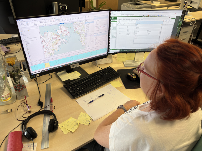
Regio’s current situation is well reflected in the makeup of our team: we now have twice as many geoinformaticians as cartographers. Even though we have fewer cartographers than before, we still produce hundreds of unique maps each year – maps are made faster, and with the help of different printing techniques, the range of map products is broad.
Back in 2005, we began close cooperation with the global navigation data provider Navtech/Navteq (later Here), which fueled rapid growth and development of the Baltic road navigation database. In 2020, a partnership with a global technology provider led to another leap in navigation data quality. Today, Regio’s Baltic states database contains about 370,000 km of roads, with data from all three countries harmonized and seamlessly integrated, enabling precise routing and navigation. The database is updated daily to ensure accuracy, reliability, and usability.
In 2024, we made another strategic technological shift – moving our database to the open-source PostgreSQL platform.
Regio’s spatial database has a precision scale of 1:5,000–1:10,000, while most of our maps are produced at 1:50,000–1:200,000. One of the biggest challenges is transforming a detailed database into a readable and aesthetically pleasing map. A cartographer’s work usually starts in ESRI software, but final adjustments are often made in Adobe InDesign or Illustrator. Our cartographers master several programs at expert level and know how to choose the best technological combination for each map.

Will Maps Survive?
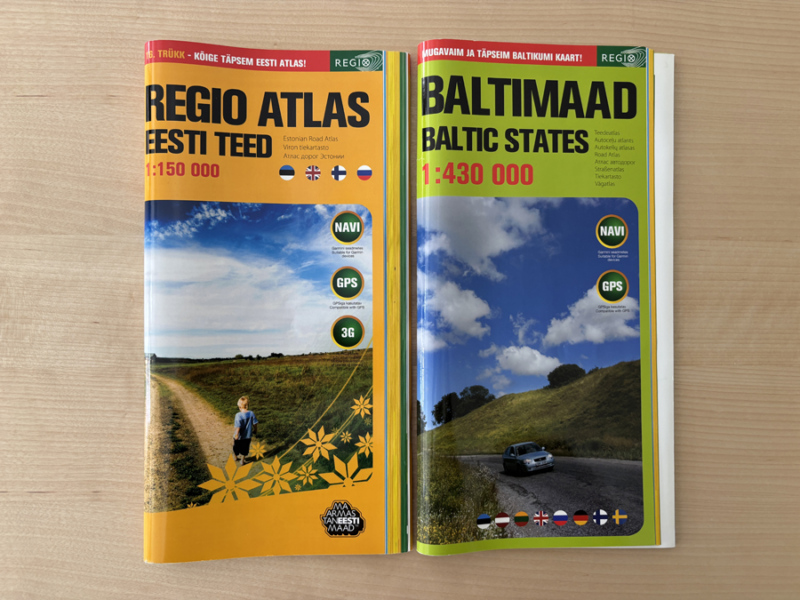
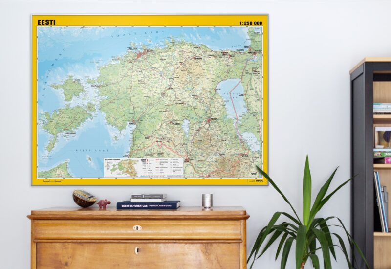
This is a question we are often asked. And today, we can say confidently: yes, (for now) they will. This year, orders for wall maps have been on the rise. A beautiful wall map brings a room to life – and that value is still highly appreciated.
 Merle Annov
