
 GER
GER  EST
EST Discover the Possibilities of Regio API in the New Demo Environment
Automatic Translation by ChatGPT
Regio’s geospatial API services enable companies and organizations to easily and quickly integrate Regio’s Baltic data into their own systems and applications.
Regio’s new API demo environment provides a comprehensive overview of the available capabilities and helps you find the services best suited for your application or information system before starting development. Here, you can test various base maps, address search, geocoding, route calculation and optimization, distance matrix, and points of interest search.
Choose the most suitable base map for your solution
In the demo environment, you can choose between three map services. The result is displayed immediately on the map, making it easy to compare which solution best meets the technical and visual requirements of your application.
- MVT – an interactive and customizable vector map
MVT (Mapbox Vector Tiles) delivers map data as vector tiles, which are rendered on the user’s device. This allows the map style to be changed dynamically and ensures smooth zooming.
A vector map maintains sharpness at every zoom level, as well as when rotating and tilting the map. MVT is well suited for interactive web and mobile applications where the map appearance or displayed information needs to be customized according to the use case. - TMS – a fast raster map with a fixed design
TMS (Tile Map Service) delivers pre-rendered raster tiles. These are optimized for fast display in both web and mobile applications.
TMS is a good choice when you need a consistent visual style and a high-performance base map. - WMS – a flexible map service for GIS solutions
WMS (Web Map Service) provides map images compliant with the OGC standard. It is particularly suitable for GIS software, desktop applications, and solutions where the map extent, projection, or image size needs to be defined.
WMS is compatible with most GIS-enabled tools. In the demo environment, you can toggle individual map layers (e.g., buildings, roads, water bodies, etc.) on and off.
Find an address or identify a location using coordinates
Regio API offers several ways to find and identify locations:
- Classic address search helps you find the correct address and its location on the map based on the entered information.
- Reverse geocoding works in the opposite direction: it identifies the nearest address based on coordinates. This can be used, for example, when a location comes from a GPS device or when a user selects a point directly on the map.
- You can also try step-by-step address search based on a place name database. This is well suited for creating autocomplete suggestions and structured address fields, helping users enter a correct address faster and with fewer errors.
Calculate and optimize routes with up to 30 waypoints
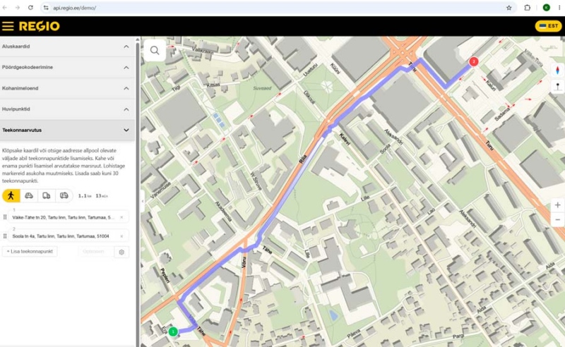
With route calculation, you can add up to 30 points per request. You can calculate a simple route from a starting point to a destination or create a multi-stop route.
If there are multiple stops, you can also optimize their order. This helps you find a more efficient sequence, reduce unnecessary kilometres, and save time. If needed, you can also create a round trip that returns to the starting point.
Four travel profiles are available:
- pedestrian
- car
- truck
- emergency vehicle
Different profiles allow the route calculation to take into account roads and restrictions that are suitable for a specific vehicle or mode of travel.
Compare distances using the distance matrix
The distance matrix calculates distances and estimated travel times between multiple locations simultaneously. The result is a clear matrix showing the distance between each pair of points and the time required to travel between them.
Explore points of interest on the map
POI (Points of Interest) search helps users find relevant locations such as shops, fuel stations, pharmacies, or parking areas.
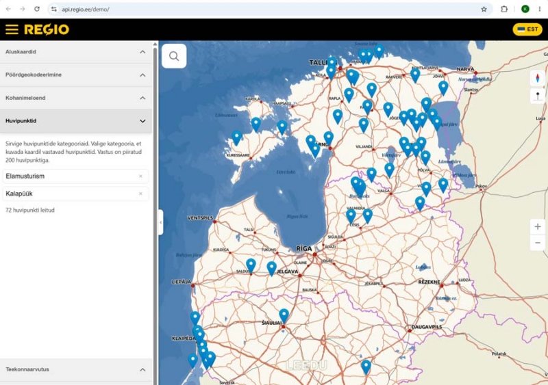
Points of interest can be selected by category, and the results are displayed on the map. Up to 200 points of interest can be returned in a single request. This functionality can be used for location-based searches as well as in applications that help users discover nearby services and places.
Try it before integrating
Regio API’s demo environment provides a quick and practical overview of how the services work. It allows you to test the functionality online and evaluate which services best fit your solution.
To get started, order a free API key from Regio. The key will be sent automatically to your email address, and you can use it immediately in the demo environment.
Regio API helps turn location data into practical solutions.
Make your location-based applications more accurate with the most up-to-date map data in the Baltic countries.
Contact us at: kaardid@regio.ee or +372 5566 7787.
 Kaspar Uba