Description
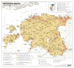
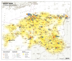
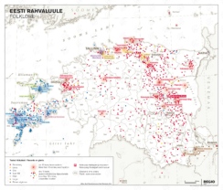
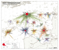
The National Atlas of Estonia (issued in 2019) is not only a guide to the world of maps, but also a book that helps to understand and study Estonian culture, history and life.
Each topic of The National Atlas is illustrated with thematic maps, specially created for the Atlas and made by Regio cartographers in collaboration with the geographers of the University of Tartu.
Enlarged reprints are available for orders.
Most of the historical maps inside the atlas can also be found in digital archive ESTER.
From the search panel drop-down menu choose ‘Title’ and write in ‘Eesti rahvusatlas’. From the page that opened select the topic you are interested in.