Geospatial API (new)
ADDRESS SEARCH, ROUTE PLANNING, BASEMAP – EVERYTHING THROUGH REGIO API SERVICES
Regio API is a remote application interface, by which data in Regio’s database is queried and forwarded to customers application / web page.
Regio geospatial database is most precise and up-to-date database which covers all three Baltic states and is updated on daily basis Regio API service is good opportunity to use spatial data and knowledge of cartography company, which has long experience in the field. You can integrate our services to your workflow and/or applications.
- Precise, up-to-date and automatically updated basemap for desktop software or web applications
- Complete address search, validating address
- Routing and directions
- Point of Intrest
It is possible to adapt our API services to customers needs.
We provide also support for service integration and development of map applications. You can read more about map applications here.
30 years of experience with maps and spatial data and 15 years of experience in software developement are connected in Regio API services
Addresses
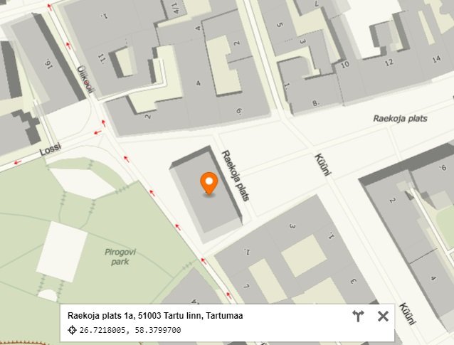
With our API service you can get access to our monthly updated address database. You can use the service on your application, web page or some other place exactly as you need. If needed, address search may return also invalid and expired addresses. Among other things, our addresses include postal codes, farm names and apartment numbers and coordinates.
Geocoding
Geocoding API lets you search for addresses from complete Estonian, Latvian and Lithuanian address database. Address coordinates can be retrived in various projections. If needed, search may return only complete address entries, for example excludes from results just a house but includes all the appartements from that house.
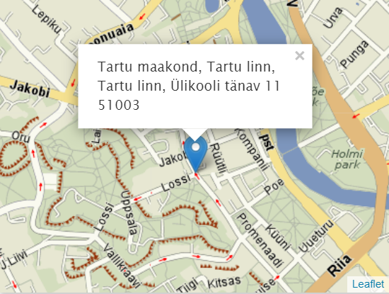
Reverse geocoding
Reverse geocoding API lets you find addresses for given coordinates, for example picked from webmap.
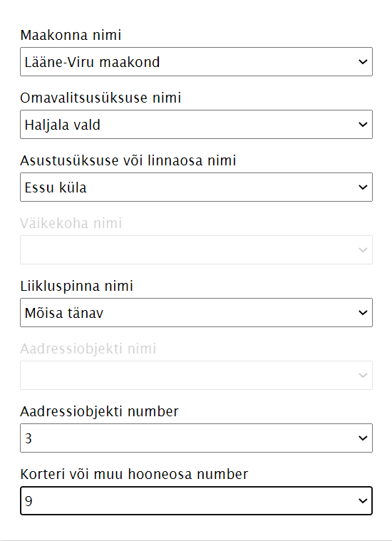
Gazetteer
Gazetteer API is a complete dictionary of our address database. By the help of gazetteer you can simply filter out correct address in text format from hierarhical address system, starting from general levels: country, county, municipality, settlement until the apartment number. The output of gazetteer allows to return also more than one address, for example it is possible to filter out all the addresses in a town. Data includes also the changes of address history.
Solving logistical tasks
by the help of our routing and directions API service in customers software and web applications.
Algorithm of routing takes into account:
- Directions
- driving lanes
- turning points
- maximum permitted driving speed
- height restrictions etc.
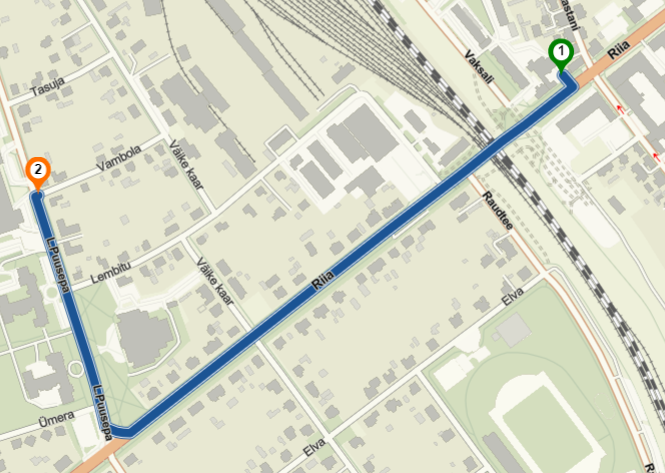
Simple routing request
Find route between two or more locations, with routing instructions in English or Estonian.
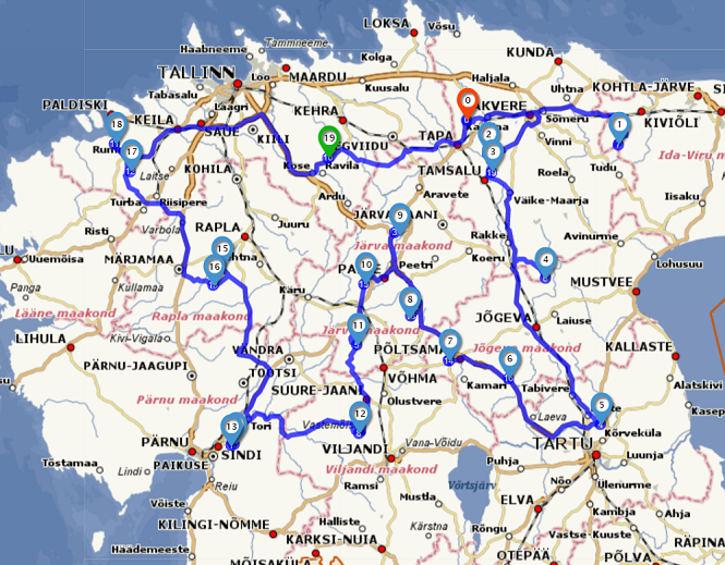
Route optimization
Find the fastest or shortest route between many locations (Traveling Salesman Problem).
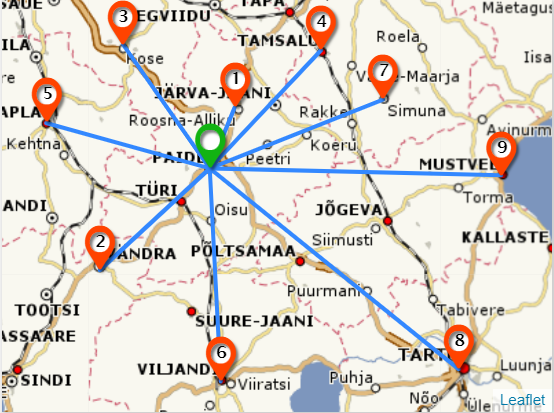
Distance Matrix
Table of distances between different starting points and destionations, in which distances are measured along the roads.
Basemaps
You can choose between vector and raster basemaps. With API the updates of basemap are forwarded automatically to customers software or application.
Raster maps
Map tiles of raster map are pre-generated by Regio. It is possible to choose between different coordinate systems.
You can choos from WMS (Web Map Service) or TMS (Tile Map Service):
- With WMS you can choose the desired data layers to visualize. The map is visualized by the pre-defined parameters (bounding box, desired layers etc). WMS map tiles are generated from the vector data, for example from .shp file or PostGIS database etc.
- With TMS you will have map tiles with fixed zooming levels, styles, projection, data layers which customer can not change. For example WMS is used for the data source.
Vector map
You can visualize vector map with animations and with other relevant visualizations. It is possible to turn the map in the direction of driving, you can also visualize it in 3D. Design of the map can be changed . Visualizing speed of vector map depends on the graphics card.
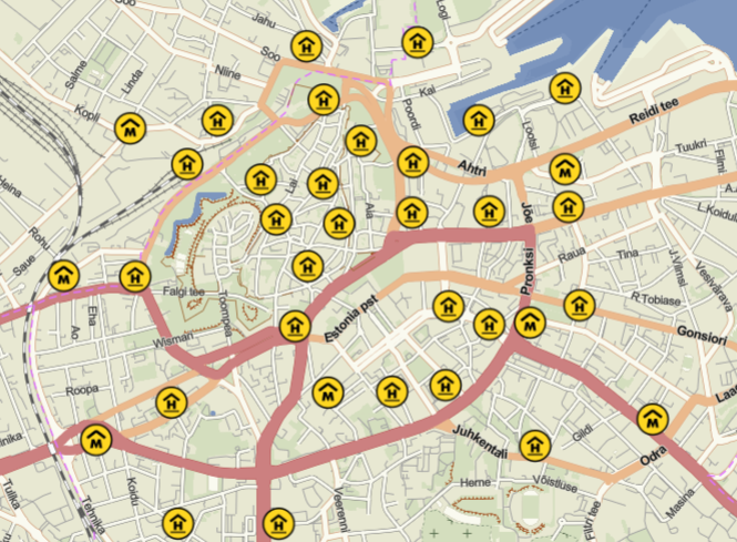
Point of Intrest
If you would like to visualize point objects on the map (e.g ATM, shopping centers, gas stations) then you would need to use Point of Intrest dataset. Our POI database includes information of objects in more than 150 different categories.
For more information please contact us by phone +372 731 0122 or by an e-mail kaardid@regio.ee